- Application of Augmented Reality (AR) and Virtual Reality (VR) to Environmental, Urban, and Civil Engineering and Architecture
- Application of Point Cloud Data Obtained by 3D Laser Scanning to Environmental, Urban, and Civil Engineering and Architecture
- Development and Application of 3D Product Models of Civil Infrastructures
- Environmental Monitoring and Knowledge Discovery for Energy Efficiency and Carbon Emission Reduction
- Maintenance and Asset Management of Infrastructures Using RFID and Wireless Sensor Networks
- Computer-aided Construction and Spatial Information
- Scope and Roles of ICT towards Smart City
|
Keywords: BIM, VR/AR, CIM, CAD, Sensing, RFID, Data Model, BEMS, etc.
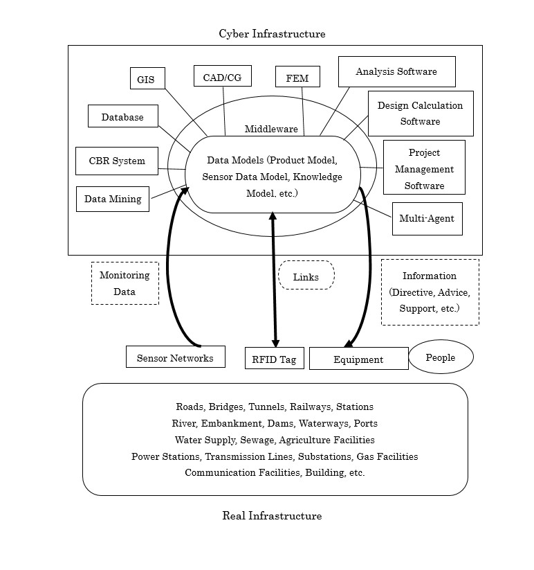
Fundamental Infrastructure Model: Integrated Cyber and Real Infrastructures
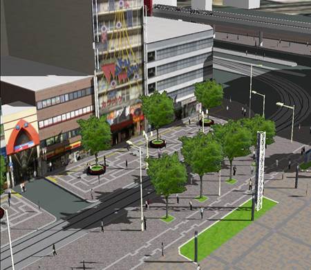
3D VR Simulation towards Building Consensus for LRT Projects in Urban Areas
|